Search

Newton Hyper-Locale Searches

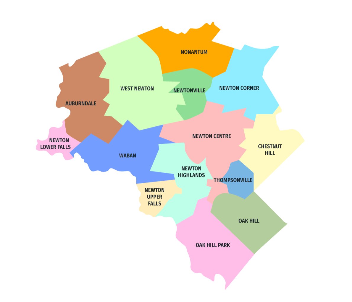
Looking for a new home in the Garden City of Newton, MA? The thirteen Villages of Newton each have their own distinguishing characteristics. Search Newton properties by Village, school district (from Elementary to Middle to High School), and by rail stop for the ultimate hyper-local perspective.
Color-coded map labeling Newton, Massachusetts, neighborhoods.

Villages Map

  • Auburndale
  • Chestnut Hill
  • Newton Centre
  • Newton Corner
  • Newton Highlands
  • Newton Lower Falls
  • Newton Upper Falls
  • Newtonville
  • Nonantum
  • Oak Hill
  • Oak Hill Park
  • Thompsonville
  • Waban
  • West Newton
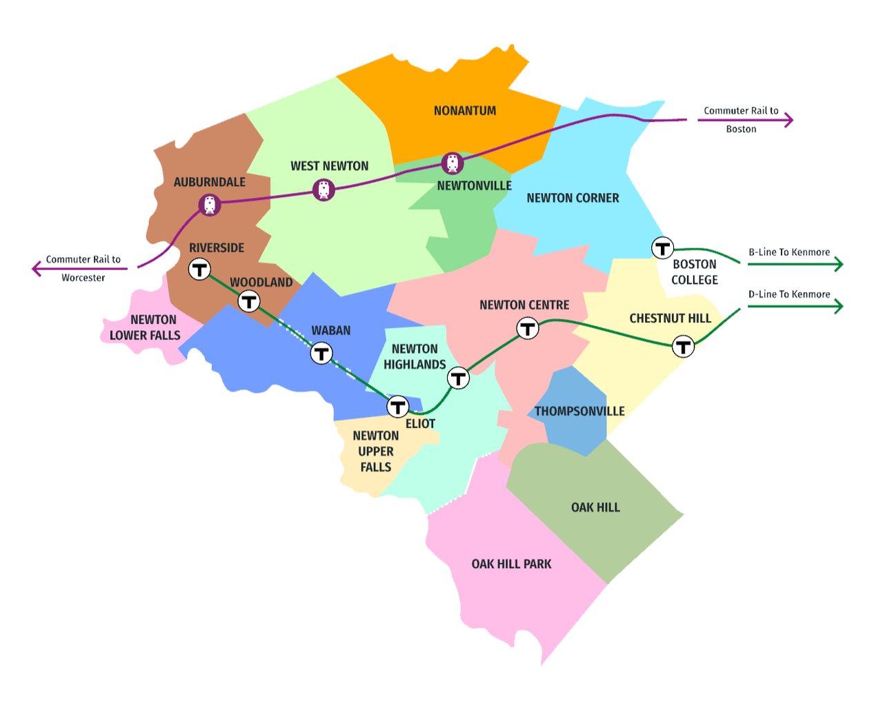
Map of Newton neighborhoods showing commuter rail stations and transit routes to Boston, Worcester, and Kenmore.

Transportation Map

Commuter Rail Stations (Purple Line)
  • Auburndale
  • West Newton
  • Newtonville
D Line to Kenmore (Green Line - D Branch)
  • Riverside
  • Woodland
  • Waban
  • Eliot
  • Newton Highlands
  • Newton Centre
  • Chestnut Hill
B Line to Kenmore (Green Line - B Branch)
  • Boston College
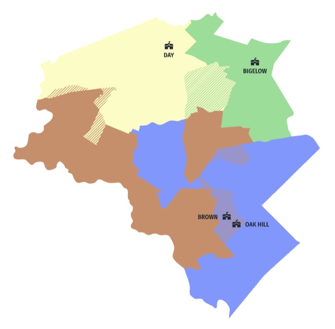
Color-coded Newton map labeled Day, Bigelow, Brown, and Oak Hill, with hatched overlapping areas.

Middle School District Map

  • Day
  • Bigelow
  • Brown
  • Oak Hill
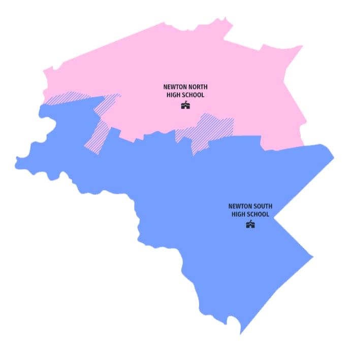
Map of Newton North and South High School areas, shown in pink and blue with hatched boundary sections.

High School District Map

  • Newton North High School
  • Newton South High School
Map of Newton neighborhoods showing commuter rail stations and transit routes to Boston, Worcester, and Kenmore.

Elementary School District Map

  • Burr
  • Williams
  • Franklin
  • Horace Mann
  • Lincoln-Eliot
  • Underwood
  • Ward
  • Cabot
  • Peirce
  • Mason-Rice
  • Bowen
  • Angier
  • Zervas
  • Countryside
  • Memorial-Spaulding